Earth and Maps · Built from a recipe
Hurricane
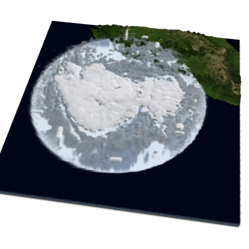
Hurricane Polo grew over the warm eastern Pacific, off the coast of Mexico, in September 2026.
- Splats
- 420,000 in its file
- Shelf
- Earth and Maps
- Kind
- Built from a recipe
- Sound
- Yes
- Licenses
- Public domain
Fire it at
How to play
Tap to play the day Polo grew from 70 to 155 knots; tap again to go back to the start.
Its controls
| Control | Kind | Range | Start |
|---|---|---|---|
| Play the day it grew | Tap | ||
| September 22 | Switch | Off |
About it
Hurricane Polo grew over the warm eastern Pacific, off the coast of Mexico, in September 2026. In the 24 hours from September 21 to 22 its strongest winds rose from 70 to 155 knots (about 290 kilometers an hour), a burst forecasters call rapid intensification, and a clear eye formed in its center.
The clouds are built from infrared pictures from NOAA's GOES-East satellite at the start and end of that day: colder cloud tops are higher, so each cloud stands as tall as its temperature says. They turn counterclockwise around the eye, faster near the center, with rain falling and low winds spiraling in. Tap it to play the day: the storm follows its best track from the National Hurricane Center, the early ragged clouds give way to the later ones, and it spins faster as it strengthens. The two pictures are real; the change between them is a blend.
Details
- Splats
- Opens at 200,000 at Mid Detail, 83,796 at Low, and up to 610,000 at Max
Sources and credits
| Work | By | License |
|---|---|---|
| GOES-East ABI band 13 (clean infrared), through NASA GIBS | NOAA NESDIS (imagery served by NASA's Global Imagery Browse Services) | Public domain |
| Best track of Hurricane Polo (EP17, 2026) | NOAA National Hurricane Center | Public domain |
| Blue Marble: Next Generation (true color), through NASA GIBS | NASA Earth Observatory | Public domain |
| ETOPO1 Global Relief Model | NOAA National Centers for Environmental Information | Public domain |